Find us on campus

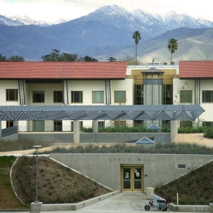
Lewis Hall

A strong partner with geospatial industry leader, Esri, the IGI thrives on the cutting-edge application of the company's innovative technologies in higher education. The IGI designs spatial instructional activities, supports spatial instruction, and teaches GIS courses; engages in interdisciplinary spatial research; creates opportunities for spatial students to participate in community-based service-learning projects; fits students to spatial internships and career opportunities; organizes spatial networking events; and supports the use of GIS for campus planning, operations, maintenance, and sustainability. Discover our geospatial programs and explore how University of Redlands faculty and students are advancing GIS education and driving innovation.
Explore At the Center of GISExplore our portfolio of student and faculty projects to see how the University of Redlands applies GIS and storytelling through ArcGIS StoryMaps. These projects demonstrate the integration of spatial analysis and narrative to address real-world issues, reflecting the interdisciplinary and applied nature of their academic work.
See URSpatial Project Portfolio See UoR Student StoryMap CollectionBringing together schools, community partners, and the University of Redlands to explore Parable of the Sower through spatial humanities. Supported by an NEH Spotlight on the Humanities Grant, the project creates an interactive map of Octavia E. Butler’s imagined California, engaging readers with the novel’s themes—climate change, race, justice, and resilience—through geography. Students across multiple courses contributed with hand-drawn and GIS-based maps, fostering interdisciplinary learning and dialogue beyond campus.
The Mamoní Valley Preserve, two hours from Panama City, is part of the biodiverse Chocó-Darién-Manabí eco-region, home to species like toucans, monkeys, and jaguars. Since May 2017, the “GIS in the Jungle” course (EVST-351) has brought undergraduates to the preserve for a three-week May Term. Students use satellite and drone imagery, hydrological data, and forest metrics to create GIS maps that support conservation efforts. They also engage with Embera and Guna indigenous communities to explore the links between rainforest preservation and cultural sovereignty.

Lewis Hall
Join our official group pages to stay informed about the latest university news, events and announcements.
Contact igi@redlands.edu with any questions, including University of Redlands drone policy.
The University of Redlands proudly hosts two major GIS events each year, in November and April, designed to inspire, educate, and engage. See more upcoming GIS events and info sessions throughout the year.