While conducting fieldwork in Alaska’s Harding Icefield, professor and environmental chemist Dr. Rebecca Lyons, was baffled by her findings.
“There was no agriculture here, and there was no industry here,” Lyons recalled. “Where was this coming from?”
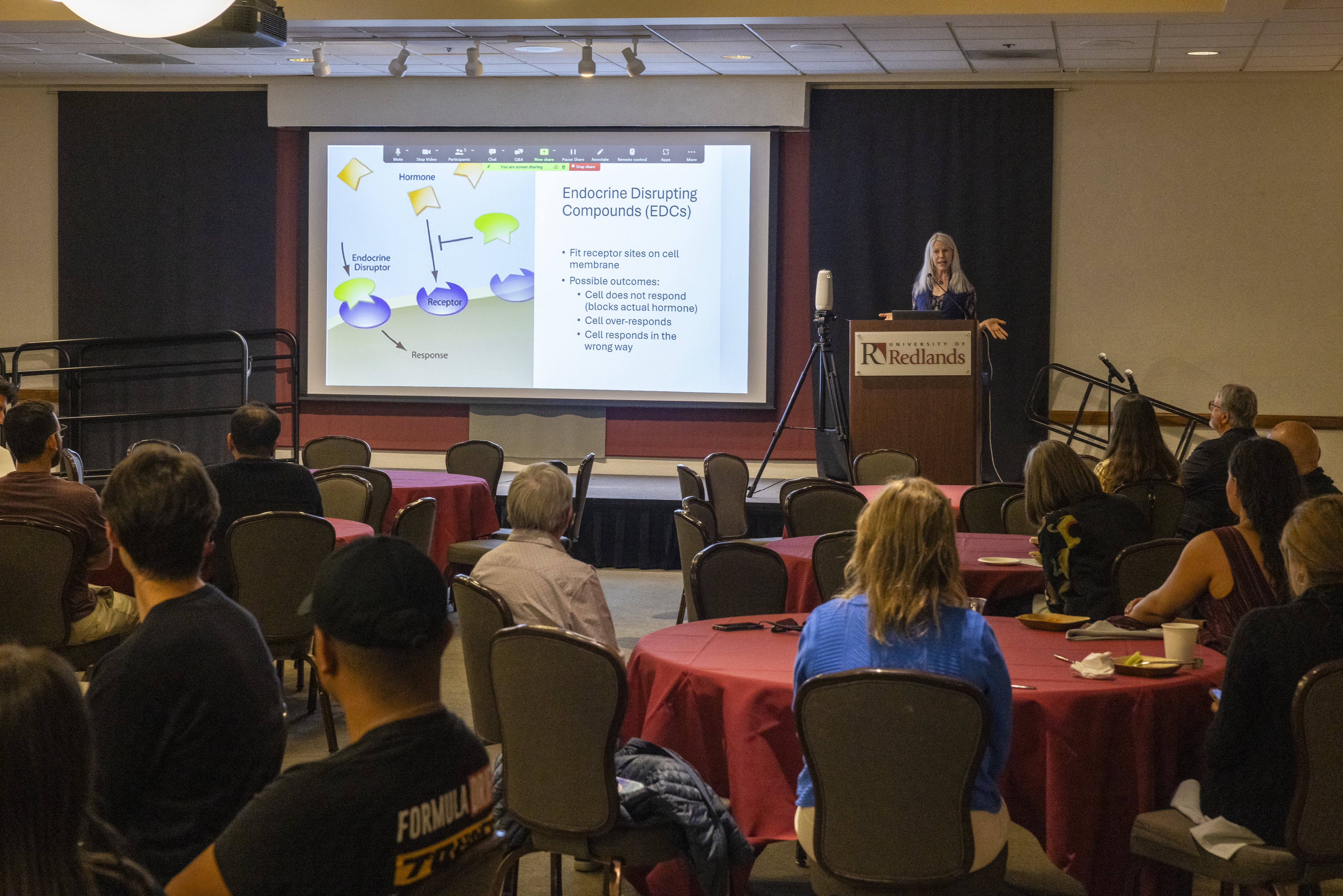
The “this” Lyons spoke of at the April 3 Spatial University Symposium is nonylphenol, an endocrine disruptor responsible for increased risks of obesity, allergies, breast cancer, and a linked neurotoxin that includes memory and behavior problems.
“Not only is nonylphenol banned in the European Union, Canada, and Japan, its parent compound, the polyethoxylated, is also banned,” Lyons said. “That is not true in the US.”
An experienced mountaineer who has spent a decade studying endocrine disruptors, Lyons is using GIS to trace endocrine disruptor entry points in California bodies of water, like those found in Sierra Nevada’s Convict Lake. Her fieldwork has taken Redlands research students to various locations, including Wyoming’s Wind River Range.
As the symposium’s keynote speaker, Lyons was joined by U of R students and colleagues in showcasing GIS through various use cases. These took form in poster presentations, lightning talks, and interactive story maps, like Dr. John Glover’s Mapping Metal project.
Started by Dr. Steven Moore, Director of the Center for Spatial Studies, the event was created to celebrate the presentations and publications of students, faculty, and staff, and to share, “all things spatial on campus.”
“It’s a great opportunity for our spatial folks to present their work and network with one another,” Moore said. “To make our community stronger and even more innovative.”
In addition to the poster presentations and keynote address, awards for excellence in GIS were given to outstanding U of R students.
“It (GIS) is the best tool we have to organize and visualize great volumes of environmental, infrastructural, demographic, political, and a myriad of other kinds of data, needed to solve the existential crises facing our future on the planet,” Moore said. “It is used to visualize where we have been, what impacts we have had on our home, and how we can make a better place for all of us to live.”
Click the link to learn more about how U of R’s brilliant faculty are using GIS to tell spatial stories.