In the captivating realm of metal music, distorted electric guitar riffs, thundering drumbeats, and powerful vocals converge to create an exhilarating listening experience. For metal enthusiasts, students, and those eager to explore a genre that is steadily gaining global popularity, there now exists a fascinating resource that offers an in-depth look into the multifaceted world of metal.
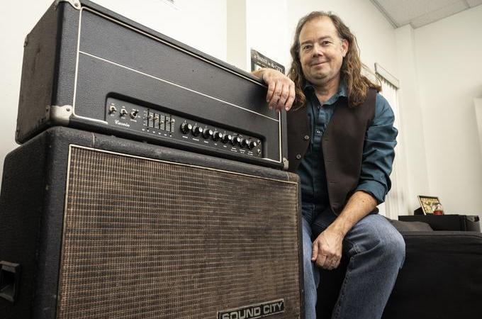
Combining his passion for metal music and historical and mapping expertise, U of R History Professor John Glover has undertaken the ambitious task of mapping metal to discover the connections between metal music and geography. This geodatabase is at the heart of Glover’s course, History 275 "Mapping Metal: A Historical Geography" which will be offered in spring 2024.
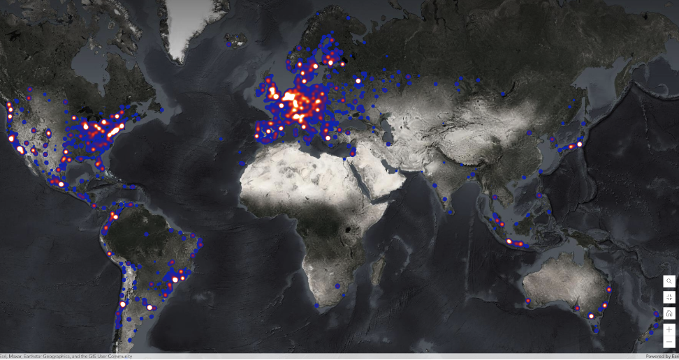
Glover utilized the Encyclopaedia Metallum, a fan-maintained website documenting information on more than 150,000 metal bands spanning eras from the 1960s to current day, to create a geodatabase that could be used in ArcOnline Map Viewer from Esri to examine the relationships between geography and metal music. His analysis incorporated variables such as subgenres (27 distinct metal subgenres), lyrical themes, band activity, record labels, and gender of members. Through this database, Glover discovered the diverse metal scenes, from Botswana’s metal bands drawing influence from indigenous music to Finland’s remarkably high density of bands: 40 metal bands per 100,000 people (about the seating capacity of the Los Angeles Memorial Coliseum).
Glover said, “Each variable can be explored independently or combined with other variables on the same map using GIS. For example, one can use the database to map the spread of ‘Thrash’ metal over time in specific countries or across the world and question why this sub-genre emerged when and where it did and what factors may have influenced its spread over time."
“Users can also map bands by lyrical theme(s) that appear in their songs,” he said. Some lyrical themes like war or religion can be global while other themes such as specific historical events or folklore can be local.” Glover believes that Esri Story Maps offers a perfect platform to communicate his discoveries by utilizing a mix of maps, narratives, and audio-visual resources, such as music videos and/or concerts.
 A global heat map indicating where the highest density of metal bands is located.
Glover recently conducted a 60-minute mapping workshop for the International Society of Metal Music Studies (ISMMS) 2023 Conference in Montreal, Canada. Every two years, this conference draws people with backgrounds in psychology, musicology, anthropology, and sociology. Glover recalled starting this year’s conference with a demonstration to a group of scholars, some in suits and others in their favorite band T-shirts. Attendees were intrigued by Glover's pioneer work in mapping metal, he said, and have suggested he return as a keynote speaker for their next conference.
University of Redlands is a leader in spatial education. With its main campus in Redlands, California, U of R is a neighbor and partner with geospatial leader Esri, and has infused spatial thinking and geographic information science throughout its academic programs in business, natural sciences, environmental sciences, social sciences, humanities, design, and other disciplines. Visit redlands.edu/gis to learn more.


