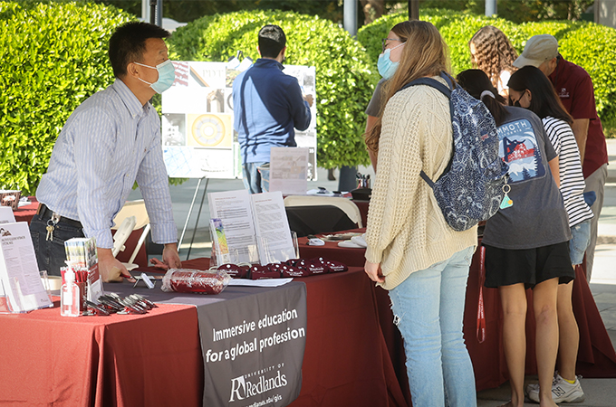
For over 20 years, people around the world have celebrated GIS Day, an annual event during Geography Awareness Week (GeoWeek) dedicated to geographic information systems (GIS) technology. Each year, the University of Redlands promotes a schedule of programming in which students, faculty, and staff members engage in a variety of geography-themed activities and celebrate spatial education in the process.
From November 15 through 19, various organizations on campus hosted events that encouraged the exploration of the importance of place—one of many opportunities for students who have an interest in geography and spatial technologies to use GIS, data science and visualization, and remote sensing to engage with the field at the U of R. This year, Geoweek programming explored topics such as global warming, racial equity, and public health and fueled conversations about leveraging maps and data to respond to crises.
“With the 26th Conference of the Parties winding down, it’s ever more important for students and other members of the Bulldog community to understand how geospatial data is analyzed and visualized to solve problems,” says Director of the Center for Spatial Studies Steve Moore, speaking to the threat of climate change. “But as the successful application of spatial tools to inform and educate policy makers and the public about the spread of COVID-19 demonstrates, progress can be made in solving global challenges. GeoWeek is a celebration of possibilities and optimism that we can join together and use spatial tools to address problems that trouble us all.”
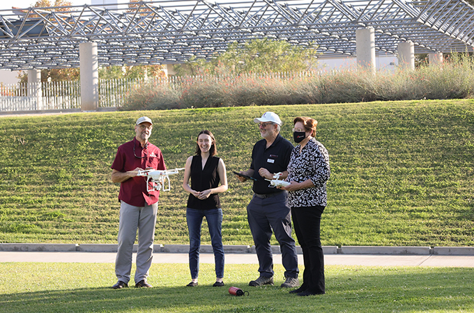
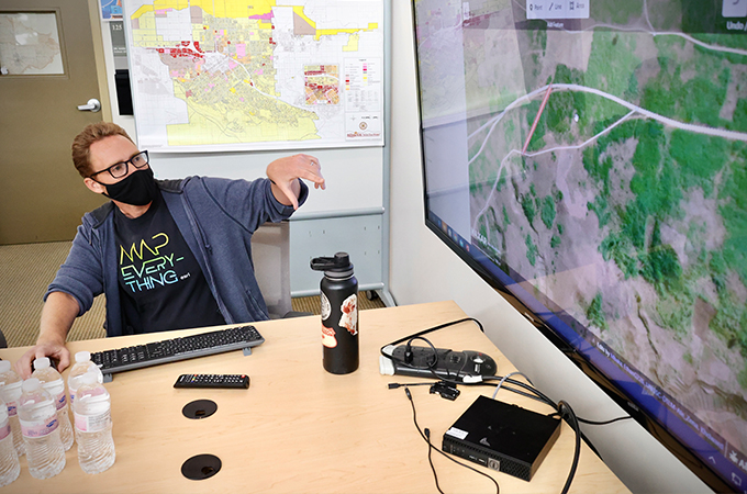
Throughout the week, students learned about the spatial studies minor, pathways into the MS GIS program, and careers in the field, while also gaining hands-on experience with Esri software and other geospatial tools. The Center for Spatial Business hosted Esri’s Yolanda Richards, who spoke about GIS-centered racial justice work in Chicago. Current MS GIS students presented their research projects during a colloquium. As a drone lifted off from the roof of Duke Hall and flew over the main Redlands campus, viewers of the livestreamed flight had a bird’s eye view of the new U of R Arrow line train station before flying over Colton Avenue.
GIS for racial justice
As part of GeoWeek, the Center for Spatial Business hosted Richards, who works closely with local government in Chicago in her role at Esri, for its most recent speaker series event. She spoke about location intelligence, social justice, and the role GIS plays in promoting equity in Chicago.
“Now in its 10th year, the Center for Spatial Business seeks to develop knowledge and thought leadership about location analytics and its applications in business and society for researchers, practitioners, students, and the community at large,” said Professor and Center Director Jim Pick, before introducing Richards.
In her work, Richards partners with different city offices, such as planning and development, the housing authority, parks and recreation, and transportation to use geospatial technology to seek to solve critical racial and equity issues within the city—from mapping public art in underserved parts of the city to researching the history of segregation and redlining.
By utilizing GIS dashboards and ArcGis StoryMaps, locating populations of concern and identifying barriers to equality becomes easier. Specifically, she has worked with Chicago’s Office of Equity and Racial Justice to map regional events for the Together We Heal initiative, a multi-pronged strategy that supports efforts to build community healing, collective reckoning, and institutional transformation. Working with the park district, Richards helped to create a cultural asset map, which outlines locations of public art in Chicago’s south and west sides.
“We truly believe that GIS is for all,” said Richards. “We are trying to do a better job of diversifying and being more dynamic in terms of how people are utilizing this space. I think it’s powerful to see how artists are using GIS, how the park district is using it specifically related to art and programming to ensure they are showcasing what’s happening in the art scene on the south and west sides of Chicago so that people can patronize businesses, go to these different spaces, and learn more about these communities.”
Richards concluded her talk with a brief explanation of how the city is using data and software to plan for the future. Utilizing city planning software, ArcGIS Urban, development teams can design amenities that will meet the diverse needs of city populations, ultimately supporting economic growth in the neighborhoods that need it most.
Hands-on experience
On November 18, students participated in the annual humanitarian mapathon, which was followed by two informational sessions about careers at Esri. This year, students gathered around their laptops in Lewis Hall and logged on to the Humanitarian OpenStreetMap Team website to map roads, trails, and paths in central Madagascar to improve access to education.
“What’s cool about what we’re doing today is that it’s not an academic project—we’re mapping for a real cause with real data that will be used for a real purpose. [This information] will be used days after you edit it,” said Director of Spatial Technology Nate Strout, who guided students through the mapping process.
The Madagascar project, which was prioritized by the United Nations, is just one of hundreds of urgent humanitarian projects that the Humanitarian OpenStreetMap Team has identified. The site is an open-source mapping software that allows members of the public to view satellite images in order to map infrastructure that will aid in humanitarian efforts—from responding to natural disasters to distributing COVID-19 vaccines.
“It is important for students to celebrate GeoWeek, where they can explore the applications of GIS in relation to their interests and future careers,” says Hannah Jugar ’23, an environmental science and spatial studies student who participated in the mapathon.
Following the mapathon, the Office of Career and Professional Development (OCPD) hosted a virtual Career Studio takeover, where Esri employees engaged with students. After answering questions about what it’s like to work at the company, Esri recruiters provided feedback on students’ resumes.
“The U of R has a strong and successful partnership with Esri—we have alumni who now work full-time at Esri and current students who have a strong interest in joining the Esri team to have a hand in the innovative work that is being done,” says OCPD Assistant Director of Employer and Alumni Connections Maria Williams. "This was a great opportunity for our Bulldogs to receive exclusive knowledge and feedback which was well-received and appreciated."
Ultimately, the aim of the week’s programming was to immerse the University community in the possibilities of GIS—something that Jugar says she has benefitted from during her time as a student.
“GeoWeek demonstrates how GIS can be applied to numerous areas of study, not just environmental science,” she says. “Many companies can use GIS in order to increase performance efficiency and sustainability and having some background knowledge in this area is beneficial. There is such a diverse application of GIS, and it's great that Redlands provides us the opportunity to learn about this useful technology.”
Learn more about spatial studies at the U of R.