The Center for Spatial Studies offered its first virtual Spatial University Symposium, a celebration of spatial learning, research, and community service, on Wednesday, April 14. University of Redlands students, faculty, and staff presented their geographic information systems (GIS) research in posters, story maps, lightning talks, and videos.
While each year's symposium typically has a theme, the center of the 2021 symposium became creating a virtual event.
"The main connection was getting everything online," Center for Spatial Studies Director Steven Moore said. "I had planned a theme of Mapping the Invisible for the 2020 symposium—seeing things that are hard to comprehend without visualization tools." While the 2020 gathering was canceled due to the pandemic, Moore noted the theme was evident in the virtual 2021 symposium.
This year's event opened a day early with a virtual space dedicated to poster and story map presentations. Participants reviewed the research and voted for one favorite story map and one favorite poster.
When 147 participants’ votes were tallied, the winning poster was "Tracing the Source of Ocean Trash" by Jingyi Huang '22. Huang created a GIS model capable of mapping sources of ocean trash, allowing implementation of trash management at the source rather than the end location.
Tanner Chapman '21 and J. Keaton Thompson '21 submitted the winning story map detailing the negative impact of wildfires and land development on Western Joshua tree. Chapman and Thompson synthesized the data they collected into maps showing threats over the last 40 years.
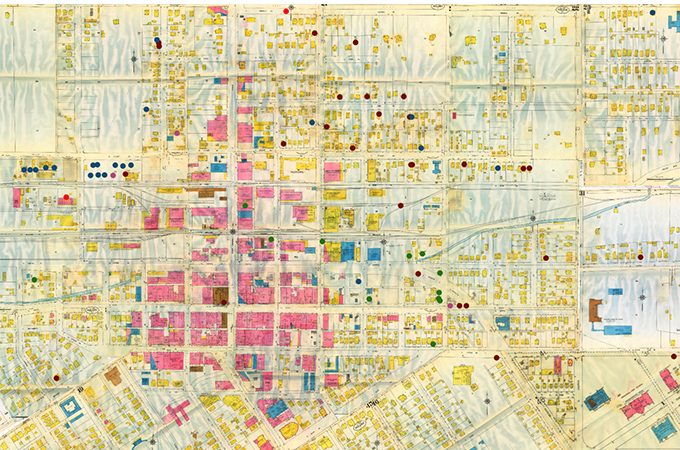
The Webex symposium presentation included seven lightning talks covering topics such as sustainability, education, and race. Mackenzie Nelson '21 and William Blach '20 presented research completed in collaboration with the Center for Spatial Studies, the Race and Ethnic Studies Department, and University of California Riverside's Public History Program to map racial segregation in areas local to the U of R. Most of their effort went into creating the data from historical sources to create their maps, reflecting the theme of mapping the invisible.
"The historical maps don't always have the best quality, the descriptions are vague, and any helpful handwritten notes written in the margins are lost due to time," Nelson said. Blach added that sources of information included charters, newspapers, voting, and school records.
Keynote speakers Jim Sandos, Farquhar professor of the American Southwest emeritus, and Tish Sandos, an independent scholar, used GIS to visualize the impact of colonialization on Native populations often left out of California's historical narrative. Spatial analysis of their research showed previously unseen examples of tribal response to the California Mission Enterprise in San Diego during the late 18th and early 19th centuries.
Faculty members presented awards to students, recognizing the creative application of geospatial technologies for research, instruction, and business. The Roger Tomlinson Prize is awarded to two College of Arts and Sciences (CAS) students for excellence in GIS. The Center for Spatial Business awards honor GIS students in the School of Business and CAS business programs. This year, the Center for Spatial Business CAS award winners would be announced after the end of the academic year.
The Center for Spatial Business awards went to:
- Tricia Methe ’21 (BSB)
- Chris Wasson ’21 (BSB)
- Mercedez Speaker ’21 (BSB)
- Jordan Gomez ’21 (MBA)
- Tridev Raut ’21 (MBA)
- Gerardo Unzueta ’21 (MBA)
Roger Tomlinson Prize for Excellence in GIS went to:
- Mackenzie Nelson ’21 (Johnston)
- Aubrianna Kinghorn ’21 (MSGIS)
Posters and story maps are available for viewing in the 2021 Spatial Symposium virtual gallery.
Learn more about the Center for Spatial Studies, the Center for Spatial Business, the MS GIS program, the MBA with a concentration in location analytics, and the Spatial Studies minor at the University of Redlands.