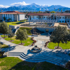
Find Us on Campus

Lewis Hall

A Master of Geographic Information Systems (MGIS) degree is a specialized graduate program focused on the advanced study and practical application of Geographic Information Systems (GIS) technology and spatial data analysis.
The Master of Geographic Information Systems (MGIS) degree is STEM-designated for professionals who look for an accelerated program to enhance their knowledge of the analysis, management, and communication of geographic information.
Through course work that includes six Esri training courses that include topics like ArcGIS Pro, WebApp Builder, Geoprocessing Scripting, Managing Geodatabases, Sharing GIS Content, and ArcGIS Enterprise, you will learn to enhance your knowledge of the analysis, management, and communication of geographic information.
In addition to having the opportunity to intern at local institutions that utilize GIS, you will be prepared for a career in GIS. The program consists of 8 months of coursework and the undertaking of an internship of 400 hours.
To view specific classes, program requirements, and coursework information, visit the current university catalog.
Nine Esri training courses are offered. Students also have unlimited access to Esri Virtual Campus classes.
Choose from the following:
Differing curriculum from MSGIS:
GIS Internship Programs: The Department currently has GIS Internship programs with a few local organizations, including the City of Riverside, City of Pomona, City of West Covina, and Mojave Water Agency.
Upon completion of this program, students will be able to:
Priority 1 Deadline: January 15
Priority 2 Deadline: June 1
Priority 1 Deadline: October 1
Priority 2 Deadline: December 1

Lewis Hall
Admissions - Graduate
Jan
08
Admissions - Graduate
Feb
19
Admissions - Graduate
Mar
12
Admissions - Graduate
Apr
16
Admissions - Graduate
May
07


In-person, Online (synchronous)
Meet 1 evening per week
12-24 months, 9-12 courses, 30 credits
STEM-designated
Professionals who look for an accelerated program to enhance their knowledge of the analysis, management, and communication of geographic information.
Opportunities to become a GIS Project Manager, Geospatial Analyst, Urban/Regional Planner, GIS Consultant, Remote Sensing Specialist, Environmental/GIS Program Manager, and more.
Get in touch with our admissions team.