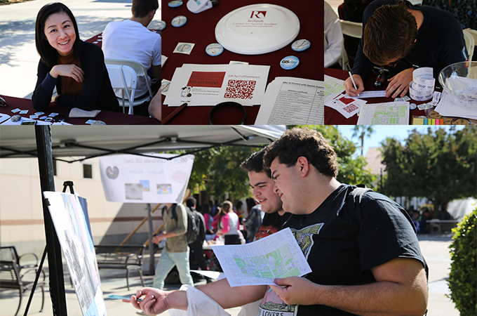
At the University of Redlands, Geography Awareness Week (GeoWeek) 2018 featured an array of events—from a showcase of student-led GIS projects to a humanitarian mapathon—all of which underlined the importance of place and celebrated spatial studies at the University.
An annual observance established by President Ronald Reagan in 1988, GeoWeek kicked off at the U of R on November 12 with Mapping Monday, a weekly seminar hosted by the Center for Spatial Studies. In this session, geographic information systems (GIS) Professor Douglas Flewelling gave a presentation on “ludospatial analysis” in video and board games.
“The word ludospatial stems from the root ludos, which means to play, and involves spatial game analytics,” said Flewelling, who also introduced a board game he developed called Campus Connection (based on the game TransAmerica), where players work together to form networks to move across the University of Redlands campus. “Creating a video game may involve redesigning a game space to encourage players to interact with each other in a social environment so they develop a sense of connection to the game.”
On Tuesday, University of Texas at Dallas postdoctoral researcher and GIS expert Christopher Franklin delivered a lecture as part of the Center for Spatial Business Speaker Series. In his presentation, which focused on home improvement retailers, Franklin spoke about how spatial thinking can be used to gain marketing insight by combining time-based and geographic models.
GIS Day on Wednesday featured a showcase of poster displays, technology demonstrations, and hands-on activities in Hunsaker Plaza. People gathered for drone demonstrations, engaged in a campus treasure hunt by using Esri’s ArcGIS software, and entered raffle contests. A Master of Science in GIS colloquium followed, exhibiting numerous graduate student projects and presentations.
On Thursday, the newly formed U of R Community Mapping Club, an on campus chapter of Youth Mappers, hosted the fourth annual GeoWeek Mapathon. During the event, participants worked on existing maps hosted and updated through a crowdsourcing process on OpenStreetMap.org, a website that serves as a sort of Wikipedia for mapping.
“The idea is that the most vulnerable places in the world are largely unmapped in terms of basic infrastructure such as roads, waterways, and buildings,” said the Center for Spatial Studies’ Director of Spatial Technologies Nate Strout. “This is information that aid workers and first responders desperately need, so many groups turn to this form of crowd-sourced data. Our mapathons usually pick the projects with the most urgent needs and we sit and map for a couple hours. The tools are easy to use and we can train people up in just a few minutes.”
Veronica Creed ’19, an environmental studies student who attended events throughout the week, added, “The spatial studies minor is a really great way to explore how GIS can help people. GeoWeek spreads spatial awareness across campus and encourages people to get involved and interested in GIS.”
GeoWeek concludes Friday with the Center for Spatial Studies’ annual disc golf tournament, which takes place at the nine-hole disc golf course on campus. The course is located along the southern side of Sylvan Boulevard, east of Anne Peppers Hall. Individuals and teams of four receive custom tournament discs and compete for prizes.
”I love GeoWeek because it brings the spatial community at the University of Redlands together to showcase fun and exciting applications of geography, spatial thinking, and technology,” said Steven Moore, director of the Center for Spatial Studies. “One week each year, students, faculty, and administrators celebrate how geospatial thinking and inquiry is incorporated into nearly everything we do here at the University of Redlands. It’s a fantastic geo-party!”
Learn more about the Center for Spatial Studies, the Center for Spatial Business, the spatial studies minor, and the MS GIS program at the University of Redlands.


