University of Redlands
 The majority of California residents live within a short distance of the ocean, yet many are surprisingly unaware of the animals that make our coasts their home. We are fortunate to have ~40 species of marine mammals along our coast and they can serve as charismatic megafauna to entice people to make an effort to learn more about marine life. Unfortunately, many of the species are endangered or threatened and baseline data is lacking for most of the populations. California’s diversity of marine mammal species are a draw to tourists and locals alike. Millions of people observe whales from boat or shore every year within our state. These encounters are often recorded by means of photographing and recording videos of the animals, yet this information is rarely shared with anyone other than a few friends and family. Currently, there is no way for researchers to access this untapped resource. We have developed a web and mobile application system, “Whale mAPP” that will allow anyone equipped with a GPS enabled smart phone to record their sightings and transmit that information to an online geodatabase that is accessible to researchers and the public.
A primary goal of this program is to educate the user about our local marine mammals; especially focusing on the threats they face, along with the efforts to help conserve their populations. GIS is an approach to manage, analyze and display geographically referenced information which allows the user to visualize data to identify trends between multiple variables. The advent of GIS has had a major influence on the study of marine ecology as many research questions address the relationship between spatial and biological data and it is a powerful tool in conservation efforts. A major strength of this project is that the user can become involved in a variety of ways, they can contribute sightings directly, access the website to learn about the species, utilize GIS to analyze the data, or ideally a user will have the opportunity to participate in all components.
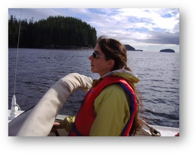
 Each spring and summer, Dr. Stelle takes students out to contribute sightings records easily via their mobile application or directly through the website, and instantly see their results displayed in comparison to other contributors. Whale mAPP is a clear example of this approach as students have the opportunity to collect data (either first-hand through whale watch trips, or indirectly by watching video clips and submitting queries of the online geodatabase) to gain an appreciation of how knowledge is acquired, and then analyzing the data with GIS software to gain experience using current technologies to apply this knowledge. They use an iterative process of making observations of the visual trends, developing hypotheses, seeking out additional data (by adding layers such as g population centers, shipping lanes or oceanographic variables), making conclusions from their analyses, and generating additional questions and hypotheses. This practice of the scientific method helps students gain an appreciation for the process and they recognize the need to consider biological, physical, economic, and cultural factors, stressing the importance of applying an interdisciplinary approach to environmental issues.